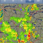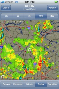
This Foreflight radar image showing the weather than blocked our path home. This was about 1.5 hours after we decided not to fly.
Pam and I had flown to Nashville on Wednesday, July 27, 2011, in a pretty much uneventful flight. We enjoyed a couple of days in Nashville and attended our business meetings. We were set to depart on Saturday, July 30th, but an early morning storm system stretching from Nashville to Chattanooga would delay our flight.
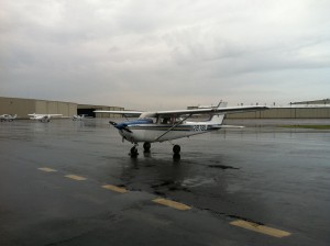
We arrived at John C. Tune Airport (KJWN) on the northwest side of Nashville at around 9:30 a.m. on Saturday. It had been raining hard this morning and there were some gloomly looking low, misty clouds coming and going, so we waited for all of it to cook off, hopefully, later in the morning. They had pulled the Cessna to the flight line from the tie down area, so I loaded her up and preflighted. Eleven o’clock came and it looked like we might be able to depart soon. But that storm system was hanging around and blocked our path home.
We decided to venture out and see if we could get home. As we sat on the flightline with engine running, the XM weather signal finally showing on the Garmin GPS 496, I took one more look at the Nexrad images on the GPS, looked over at Pam, and said that I didn’t think we should depart. So, Pam agreed, and we shut down, rented a car and drove the 455 miles back home to Columbia. It wasn’t an unpleasant drive, but almost eight hours. We had planned from the beginning to rent a car and drive home if the weather was iffy, so plan B it was.

This Foreflight radar image showing the weather than blocked our path home. This was about 1.5 hours after we decided not to fly.


