On Wednesday, July 16, 2008, Pam, Kayla, Mallory, and I departed Columbia (KCUB) at around 10:00 a.m. and traveled to Reynolds, Indiana, to see Pam’s sisters and their families.
We took off from Owens Field a little later than we wanted to due to some marginal VFR in the upstate between us and Asheville. As the weather reports predicted, the low cast was gone by the time we got to the upstate. We were at 4500 feet until around Spartanburg and the mountains south of Asheville. We climbed to 6500 feet south of Hogback Mountain and over flew the Asheville area and were treated to beautiful mountain views, with Mount Mitchell towering hazily far to the east.
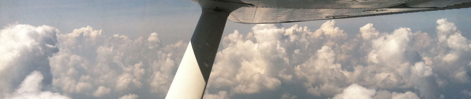
As we ventured on over the Blue Ridge Mountains we climbed to 8500 feet to give us a good margin to clear the Great Smoky Mountains into Tennessee. For a while we were flying under a cloud layer that was getting close above us so we descended to 6500 feet and enjoyed some beautiful views of the rippled and raked terrain of the northeastern Tennessee and southeastern Kentucky cumberland landscape.
After about two and a half hours, we landed at London-Corbin Airport (KLOZ) in Kentucky for our fuel stop and to let everyone stretch their legs and take a break. The runway at London is 150 feet wide so my landing flare was a bit high as I am so used to the view of CUB’s 75 foot wide runway. We were still well above the runway when I expected my tires to be touching, but we continued to sink right down and down until finally a couple of mild barks of the tires and we were there.
London is an excellent airport. The folks were friendly and the FBO was large and very well maintained. The lady at the desk said there was a restaurant on the field, but was closed for now and would reopen on August 1st. The girls and I were hungry and had to settle for snacks from the machine. Perhaps we’ll venture back to London someday and try it out The Hangar Restaurant.
On past Lexington, Kentucky, and west of Cincinnati, we flew. The girls slept on and off as Pam and I both worked the cockpit. Pam changed frequencies as required and wrote down flight and ATC numbers – and thank goodness! Cincinnatihanded us off to Indianapolis and I reached over to set the transponder code. What a goofball! I quickly realized that I had changed the transponder to the altimeter setting. I was thinking, “Oh $&@!#!” Thanks goodness Pam had written it down. I changed it back so quickly that perhaps ATC didn’t notice, I hoped.
The flight was pleasantly smooth at 6500 feet. We descended to 4500 feet just beyond Lexington to clear the scattered layer and put it above us. Cincinnati routed us east and around some restricted area and an active MOA and then we were straight on course again southeast of Indianapolis. The terrain was flat farmland as far as the I could see. Beautiful country! We descended to 2500 feet for the last thirty minutes of the flight. There is no shortage of places to land if an emergency were to arise. We radioed White County about ten miles out and listened for traffic. We were met by Pam’s sister, Sharon, who was waiting for us on the porch of the FBO. Since we had an Automaic Position Reporting System (APRS) onboard,Sharon had been monitoring our flight on the internet all day so she knew about when she needed to be at the airport.
White County Airport is a nice venue. It sits two miles south of the town of Monticello and on the west side of the north-to-south runn
in
g, snake-like Lake Freeman. We taxied up to the FBO and parked at a tiedown. The FBO is a small and simple looking structure parked under a larger oak tree. The FBO staff was very welcoming and friendly. White County has a new FBO that was built behind the existing FBO which will be torn down as soon as the new one is up and operating. We were given a tour of the new FBO by Phil Gutwein, a prominent figure in the community as well as the Airport Board President. The new FBO is much larger, has vaulted ceilings covered with wood panels, giving it a warm and welcome feel. It is absolutely beautiful! They also plan to widen and lengthen the runway and improve the taxiways and parking areas.
In Reynolds, we enjoyed a week of Indiana farm life. There is corn growing everywhere. Pam gave me the grand tour of the area. Pam’s sister, Sharon, and her husband, Ron, and their family farm about 3500 acres in the area and are gearing up for suppling corn to an ethanol producing plant being built next to his land. Corn is king right now in this area. Ron gave me a tour of his farm equipment and even let me drive one of his John Deere riding mowers. This was a heavy duty machine, not the kind you find at Lowe’s.\
Pam, the kids, and I got a chance to go to Indiana Beach, a local theme park located on Lake Freeman, a couple of miles north of Monticello. All week while we were there, the White County fair was taking place only a block from Ron andSharon‘s house. There were craft displays and judging, farm livestock contests and plenty of great food. The fresh made vanilla ice cream was the best I ever had.
The last day before we were to depart, I got a chance to take Ron and Pam’s other sister, Sheila, for an airplane ride. We toured Reynolds, and Monon to the north, where Pam’s parents used to live, and flew over a bunch of Ron’s farmland. We flew over Indiana Beach and circled over Ron and Sharon‘s house a few times, and then flew back to the airport. It was a great visit, and educational as well. I never realized how high-tech farming actually is, with GPS driven farm machinery, vast drainage systems and canals, to the impressive crop dusters with their turbo props. We got to watch several fly over the fields during our stay and got to watch them take off and land at the airport. They sound like P-51 Mustangs – loud, strong and commanding in their presence.
Our week in Indiana had gone by quickly and it was time to head back to South Carolina. I had been keeping track of the weather on Weathermeister.com everyday, and it looked like Tuesday, July 22, was our best weather window. Back at the airport, we loaded up, fueled up on the self-serve pump, and departed around 10:00 a.m. We climbed above some lightly scattered clouds to 2500 feet and enjoyed a smooth cruise to the south. I chose to fly a route south towards Atlanta and then east to Columbia because the weather reports indicated cumulus clouds building at 5000 feet about the time we would expect to be over the mountains towards Asheville. So we planned a stop in Tennessee for fuel, fly south towards Atlanta and then once out of mountainous terrain, make a course east to Columbia.
The flight started out nicely, but we got zig-zagged a bit by ATC around Louisville and Fort Knox. We could have done without that. It cost us 10 or 15 minutes of flying time and more importantly, fuel. Over the Kentucky foothills, the sky was very hazy and it was getting hot. Kayla was not feeling well so we began to divert to a nearby airport. I checked the chart for airport information and it indicated that the runway was only 2600 feet and there was no fuel service. With the density altitude reports of 3900 feet in our area, we decided to continue for the twenty to thirty minutes longer to our planned stop at Crossville, Tennessee. Their “fuel pumps were not operating,” so we had to fly east a few miles to Rockwood (KRKW) where we topped off.
The weather was looking very bad, so we tied down for the night. While still at the FBO, a bad storm came thru and it rained as hard as I had ever seen and the winds were blowing hard, and the lightning was flash-booming on the airport property. Pam and I were looking out of the FBO at the heavy rains and wind and suddenly the wind shifted and you could hear that spooky whoozing wind sound through the gap in the FBO door. I told Pam, “That sounds tornadic!” And suddenly, she yelled, “That plane is moving!” Then she told the girls to get into the bathroom and rushed off to usher them in. We both had just seen a twelve and a half ton, three mi
llion dollar business jet parked on the tarmac skid around ninety degrees, trying to vane into the hard-blowing wind and rain. The FBO operator came running out of his office and ran outside in a panic. Realizing there was not much he could do in the rain, wind, and lightning, he came back inside the FBO to wait it out. After the hard rains and wind subsided, he went out to secure the by parking his truck in front of the aircraft.
With the excitement over, we rented a car and drove a few miles to nearby Harriman off of I-40, ate a nice meal and stayed the night at a motel. The next morning, the weather was not very promising as there was a heavy fog that concealed the hilltops. It was predicted to lift by 9:00 a.m. but it was lifting slowly. We made our way back to the airport and Pam turned the car in as I gave Betsy a good preflight inspection – making sure to note if any water had collected in the aft fuse and tested the fuel several times. This is the first time Betsy had to stay outside in bad weather since I have been flying her. It was no surprise that there was some water in the one of the fuel tanks, but it wasn’t very much. Betsy was ready, so we loaded up, cranked up and taxied to runway four.
Flight service had reported 1200 scattered at the closest reporting station and clear to 12,000 feet. With Rockwood’s field elevation at around 1660 feet that seems interesting to ponder. Rockwood airport is on top of a hill. It looks like they just shaved off the top and put the airport on it. Looking down in the valleys around the airport we could only see low clouds all around. Some clouds above us were starting to move in as we prepared for our flight, but it looked clear above them.
We departed around 10:00 a.m. and headed south. We climbed out to 3500 feet first and then climbed to 5500 feet, weaving our way around clouds and trying to stay out of them. With severe clear above them we found our comfortable altitude at 7500 feet. Flight Watch reported that our waypoint airport, Pickens County (KJZP), north of Atlanta was now 1200 feet overcast. They advised Gainesville to the east was reporting scattered, so we immediately changed course to the east. As we fly closer to Gainsville, although well north of it, the sky opened up nicely and the scattered clouds became sparse.
On to towards Columbia we flew with the girls sleeping soundly in the back seat. We descended to 5500 feet at the Georgia/South Carolina border and then to 3500 at Abbeville. The air was bumpy there so we climbed back to 5500 feet until we contacted Columbia Approach. Columbia directed us straight down the center of Lake Murray as we descended, which made for much smoother flying over the water. By the time we reach the dam, we were at 2500 feet at ATC gave us the go ahead direct to CUB.
Once on the ground, we got Betsy topped off again and put her in the hangar. Pam and I both gave her a kiss on the cowling and a hug – a thank you of sorts for taking care of us. We had flown our first long cross country – to Indiana and back! Loaded with kids and luggage and looking for adventure, we had flown the Appalachian Mountains, toured the geographic marvel of the Tennessee and Kentucky cumberlands, the vast flat farmlands of Indiana, and the foothills of Kentucky andTennessee.
In retrospect as a pilot, this trip demanded from me almost everything that I know about flying. What piloting skills and knowledge I possess, I used – what I lacked was revealed. And thinking back, the trip seems like a dream – too good to be true. Thanks goodness we have plenty of pictures to remind us of this wonderful adventure.